


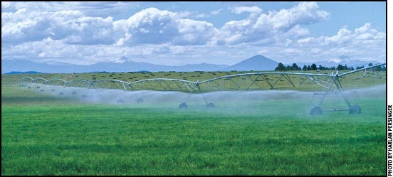
Irrigation Tools
Irrigation water management is important every year.
A few years ago, the Nebraska Panhandle and eastern Wyoming were in the grips of a drought, irrigation water supplies were limited, and the North Platte River reservoirs were almost empty. Then we had three years of plentiful water supplies.
This year should also provide adequate water; however, with the low snow pack in the mountains this year, we may not be so fortunate in 2013. Surface irrigation water supplies may be limited, and limits on the amount of groundwater pumping have been established in all of the Panhandle natural resource districts (NRDs).
Irrigation water management should be practiced every growing season to ensure this limited resource is utilized properly. Growers need to apply the water in the amounts needed by the crops in a timely manner to save money by reducing pumping costs and maintenance on their equipment by only running the pumps and center pivots when necessary.
There are several tools to help growers manage their irrigation water supplies. One tool is soil water sensors, instruments placed in the soil at different depths to represent the crop's effective root zone and measure the amount of soil water content at those depths.
These sensors are connected to a monitor that records readings of soil water content. The sensors can be read manually by the grower from the monitor box readout, or can be downloaded to a hand meter.
- Once the grower has the readings, he or she can go to the University of Nebraska–Lincoln (UNL) Nebraska Agricultural Water Management Network website, water.unl.edu/web/cropswater/nawmdn, and click on the link "Watermark Sensor Reading Calculator," which will take them to the calculator page.
- From the drop-down box, the grower selects the appropriate soil type, then enters the readings from the soil water sensors from the appropriate depths and clicks the "Calculate" button.
- Based on the soil type, the website will then display how much water is depleted from the top 3 feet (ft.) of soil, or, in other words, how much water the soil can hold in the top 3 ft. The program also determines how much water is remaining in the top 3 ft. of the soil.
- The grower will also get an AVERAGE reading of the sensors down to the 3-ft. depth. By clicking on the blue link "Table – Watermark™ sensor centibar reading vs. soil texture water (inches)," the grower will be directed to a page that shows the suggested trigger points at which the grower should start irrigating based on the AVERAGE reading down to 3 ft. and the soil type.
- Knowing the soil type in the field and tracking the amount of water removed by the crop are used to determine how much water should be applied. The grower can then schedule irrigation applications based on the soil's ability to hold a certain amount of water and what the estimated crop water use will be in the coming week.
Sensors should be placed in the crop while the crops are small. Anyone interested in obtaining and installing these sensors should contact the local Natural Resource Conservation Services (NRCS) office, NRD office or fertilizer dealer.
The other instrument available for growers is the ET gage, or atmometer. This instrument simulates the evapotranspiration of an alfalfa crop. A reading from this instrument is taken once a week. This reading is then applied to a given crop growth stage and given crop conversion factor to determine how much water the crop used during the previous week.
This sounds like it might be lot of work and complicated, but it isn't. Through the help of the North and South Platte and Upper Niobrara White NRDs, the Nebraska Department of Natural Resources, and the UNL Panhandle Research and Extension Center Biosystems Engineering and the Soils and Fertility programs, there is a network of these ET gages established across the Nebraska Panhandle and eastern Wyoming, and sponsors for other parts of the state.
This information is at the UNL Water: Agricultural Irrigation (water.unl.edu/web/cropswater/home) website.
- Go to this web site and click on the "Agricultural Water Management Network" link found in the left column.
- Click on the link found in the center of the page for "View Weekly ETgage® data and local reference ET weather station data." This will bring up a page showing the state of Nebraska and its counties.
- Select a county and click on it. This will bring up the county map and red balloon markers where there are (alfalfa) ET gage sites. The blue balloon markers are where weather stations are located. And something new this year, the green balloon markers are grass ET gage sites (more on these later).
- Select a red balloon marker/ET gage site closest to your farm/field and click on that marker. This will bring up a page with a chart that lists crops across the top; select a crop.
- Down the left side of the chart are crop growth stages. Select the crop growth stage of your crop and move right across the chart to where it intersects with the column with latest data entry date for the ET gage reading. Where these come together is the estimated number for crop water use in inches for the previous week. Growers can use these numbers to estimate their crop's water use on a weekly basis as the growing season progresses.
The green (grass) ET gage sites have been established to help determine or show grass (lawn) water use across the Panhandle. There are sites in the major cities and villages throughout the Panhandle that may be useful for the homeowner.
Updates for the Nebraska Panhandle and eastern Wyoming ET gage sites, Torrington and Lingle, are usually completed by noon each Tuesday, with the previous week's readings. Readings will be posted to the website beginning in late May through early September. The different crop growth stage charts can be downloaded or printed off and taken to the field to help assist the grower in determining crop growth stage.
Anyone interested in obtaining and installing an ET gage should contact the local NRCS office or NRD office to see if they offer assistance.
Other useful UNL websites you are encouraged to view:
- UNL Water — water.unl.edu/home
- UNL CropWatch — cropwatch.unl.edu/
These sites contain a lot of up-to-date, useful information or links for the grower, home gardener and consumer.
Editor's Note: This article was provided by the Panhandle Research and Extension Center, which is available on the World Wide Web at panhandle.unl.edu.